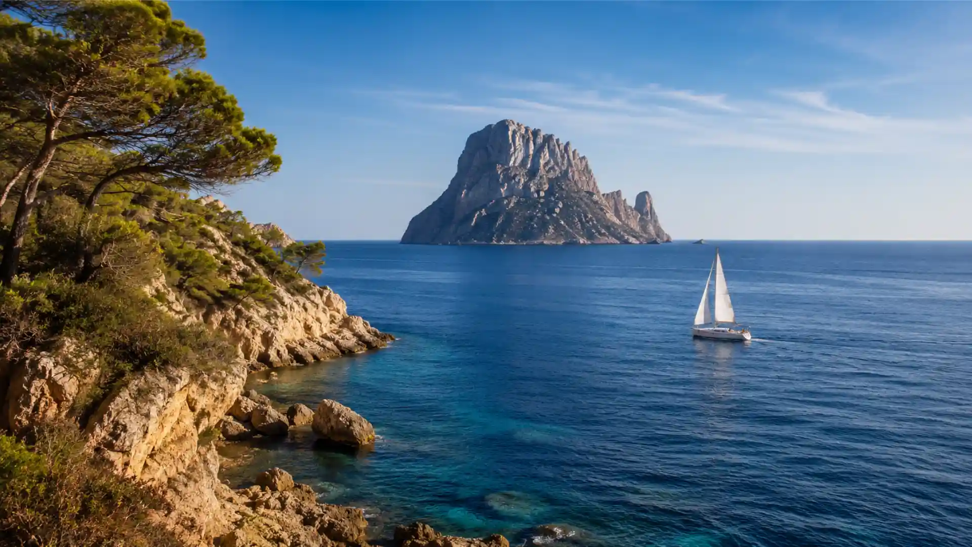
There are days in Ibiza when the sea dawns practically still. The surface still retains the smooth texture of the night, the anchored boats barely turn, and for the first few hours, it's hard to imagine that a few hours later a sufficiently constant air current could establish itself to completely change the feeling of sailing.
This change is not always associated with a storm, a front, or a significant alteration in the general weather pattern. Under stable conditions, part of this evolution can be explained by the temperature contrast between the island and the Mediterranean.
This is what is usually identified, in nautical language, as thermal wind in Ibiza.
However, a clarification is necessary. Ibiza does not necessarily develop an island breeze system as extensive and well-defined as that of larger territories. Its size, irregular topography, and the influence of the synoptic wind make the phenomenon more complex. In practice, what is observed from the sea are local circulations that appear, strengthen, or disappear depending on the heating of the land, the orientation of each coastline, and the winds present beyond the island's immediate influence.
For those who sail around Ibiza with some frequency, understanding these variations allows for a better interpretation of a sea that rarely behaves in the same way throughout the day.
What do we really mean by thermal wind?
The physical principle is relatively simple.
During daylight hours, the land's surface heats up more quickly than the water. The Mediterranean has enormous thermal inertia: it takes much longer for its temperature to rise or fall. The island's rocks, soil, and vegetation respond considerably more rapidly.
Air above land heats up through contact with the surface, loses density, and tends to rise. This temperature difference can generate a small pressure gradient between land and sea.
The result is an air circulation from the sea towards the coast.
That is the basis of the sea breeze in IbizaHowever, over real water the situation is rarely as clear as in a weather diagram.
The prevailing winds persist. The topography channels the flow. Headlands accelerate the air. Some cliffs create shadow zones. Large coastal inlets can orient the circulation differently than would be indicated solely by the regional gradient.
That is why two vessels separated by only a few miles can encounter significantly different intensities and even directions.
The difference between thermal wind and synoptic wind
One of the common mistakes is to interpret any increase in wind during the afternoon as a thermal phenomenon.
It isn't necessarily so.
Synoptic winds are a consequence of much larger-scale atmospheric systems: anticyclones, depressions, and pressure gradients that affect extensive areas of the Mediterranean. They can persist overnight, cross the island with intensity, and influence sea conditions for many hours.
Thermal wind has a more local nature.
Its appearance depends largely on the contrast between land and sea and, therefore, on the day's temperature changes. It is usually more noticeable when the overall atmospheric conditions are relatively stable and the prevailing wind is not strong enough to completely dominate.
They can also interact.
If the prevailing wind blows in a direction compatible with the thermal circulation of a particular coastline, the wind speeds can add up. If they blow in opposite directions, they can weaken each other or create areas where the wind is particularly erratic.
This overlap explains many of the changes experienced when sailing around an island.
How it usually evolves during the day
Although it should never be used as a rigid rule of prediction, daily evolution helps to understand the phenomenon.
At dawn, the temperature difference between land and water is usually limited. Local winds may be weak, and surface conditions particularly calm if there is no significant general flow.
As the sun heats the ground, the contrast begins to establish itself.
The process is not instantaneous. The atmosphere needs time to respond and organize a local circulation. During this phase, there may be minutes of apparent calm, small wind shifts, or gusts that do not yet show a stable direction.
Later, when the Earth's warming becomes sufficient, the flow can consolidate.
It is precisely this progression that causes the same area to present very different conditions between morning and afternoon without the need for a major meteorological change to have occurred.
When solar radiation decreases and the earth begins to lose temperature, the mechanism weakens again.
Why the phenomenon doesn't behave the same around all of Ibiza
An island is not a weather station placed in the middle of the sea.
Ibiza has headlands, bays, small mountain ranges, cliffs, open valleys, and coastlines with very different orientations. All these elements distort the flow.
On a coast directly exposed to air flowing in from the sea, the air circulation can be clearly felt. A short distance away, behind a prominent feature, a vessel may find itself in a considerably more sheltered area.
The difference also appears between the interior of a cove and its entrance.
A narrow inlet can channel the air and locally increase its speed. In other cases, the opposite occurs: cliffs generate a wind shadow near land while outside the cove the flow continues established.
That contrast is especially deceptive from an anchored position.
From the deck, surrounded by the coast and seemingly sheltered, the outside conditions may appear similar. However, once you pass the point that protects the cove, you'll find a significantly stronger wind.
Capes and points: where air can accelerate
Geographical features are especially relevant to understanding the local wind in Ibiza.
When an air mass encounters a coastline and must adapt to the topography, certain areas concentrate the flow. Exposed headlands are classic locations where this acceleration can be observed.
In navigation, the change can be felt quite quickly.
A vessel moving along a sheltered coastline may encounter a significant increase in wind as it approaches a headland. This is sometimes accompanied by shallower seas, a darkened surface, and small ridges that allow the vessel to visually anticipate the transition before reaching it.
After folding the rope, the opposite effect can occur.
This doesn't mean the wind has disappeared across the entire area. It simply means the terrain has changed.
This spatial reading of the wind is one of the fundamental differences between observing a weather forecast and understanding what is actually happening over the water.
Cleats also have their own aerodynamics
The coves of Ibiza may seem like meteorologically simple places, but they are not.
Its orientation determines which winds enter directly and which are partially blocked. The height of the banks modifies the flow. The width of the inlet influences internal ventilation, and the terrain configuration can produce unexpected channeling.
In some coves, the air enters quite aligned with the cove.
In others, the flow passes over the relief and reaches the water in the form of downward and irregular gusts.
This has a direct consequence on anchoring: the apparent wind direction near the coast does not always accurately represent the situation a few hundred meters further out.
It can also happen that anchored vessels have slightly different orientations within the same cove, especially when the wind is weak and competing with small local currents.
Thermal winds also transform the state of the sea
Wind is not just air moving over a vessel. With enough travel over the surface—the so-called fetch— begins to transfer energy to the water.
When the thermal wind establishes itself for several hours, it can raise a small local swell even on days without significant groundswell.
The shape of that wave depends on the intensity, the length of time the wind has blown, and the distance available for it to develop.
In areas close to the coast, the result is usually a relatively shallow sea.
It doesn't take a significant height to be noticeable. A small wave facing the direction can greatly affect the comfort of a fast boat, especially when traveling at high speed.
That's why observing the surface provides useful information.
The first darker areas, small lines of foam, or a different texture in the water can indicate that the wind is increasing several minutes before you fully feel its effects.
Ibiza and Formentera: two landmasses that complicate the flow
The proximity between Ibiza and Formentera introduces another layer of complexity.
Between the two islands, air currents interact with opposing coastlines, relatively narrow passages, and abrupt changes in direction. Wind behavior is not necessarily identical to that found a few miles further east or west.
Added to this is the difference between sailing close to land and doing so in more open spaces.
Moving away from the immediate influence of the terrain allows the general wind to manifest itself more clearly. Upon approaching a coast again, local effects reappear, such as zones of acceleration, sheltered areas, and changes in direction.
That transition is particularly interesting in the thermal wind navigation because it demonstrates that the wind experienced does not belong solely to a large atmospheric mass: it is also being continuously shaped by geography.
Why a weather app doesn't tell the whole story
Modern forecasts are extraordinarily useful, but any model works with a limited resolution.
A small cape, a cliff face, or a narrow cove may have effects that are too local to be accurately reflected in a general forecast.
In addition, many applications display the calculated wind speed for a given grid square. This data represents an area, not necessarily the exact location of a vessel.
That is why there can be a considerable difference between the figure shown on the screen and the wind felt inside a cove.
It does not necessarily mean that the forecast is incorrect.
This means that the real atmosphere contains phenomena on a smaller scale than that represented by certain models.
Marine forecasting, sky observation, surface reading, and knowledge of relief should be interpreted as complementary layers of the same information.
Read the water before the anemometer
Nautical experience develops a certain ability to observe the wind before even measuring it.
A band of darker water usually indicates a rougher surface. Small white ridges show that energy transferred to the sea is increasing. Flags on land, the orientation of other vessels, or the way anchored ships rotate provide additional clues.
The horizon does too.
On a completely smooth surface, it's easy to see where the wind-affected water begins. That boundary can slowly advance toward a vessel until it reaches it.
It is a simple observation, but extremely useful for understanding the evolution of a day.
The instruments confirm what is happening; the sea, many times, had already announced it.
What conditions favor a clearer thermal development?
Breeze episodes are generally best defined when there is sufficient sunshine and the prevailing wind does not completely dominate the local circulation. The basic mechanism is due to the differential heating between the land surface and the sea: the land heats up faster, warming the lower layers of air and creating a gradient that draws air from the sea towards the coast.
In Ibiza, that principle should be interpreted with caution.
The island is smaller than other Mediterranean territories, and its thermal circulation on an island scale doesn't necessarily follow the same pattern. Therefore, it's more useful to talk about local thermal variations combined with the general wind rather than imagining a single pattern applicable to the entire coast.
Days with stable atmospheres can show these contrasts very well.
Conversely, when there is a strong synoptic gradient, the general circulation usually prevails and thermal effects become secondary or simply slightly modify the prevailing wind.
The importance of observing the trend, not just the data
At sea, a single figure says less than a trend.
A wind of a certain intensity that has been decreasing for hours describes a different situation from another with exactly the same intensity but increasing progressively.
The same applies to the address.
A gradual roll accompanied by a regular increase may indicate a circulation that is finishing organizing. Abrupt and erratic changes may be due to local turbulence, topography, or interaction between different flows.
La sailing in Ibiza It forces us to pay attention precisely to that evolution.
It's not enough to know what the wind is like.
It is important to understand where it comes from, what is causing it, and what can happen when the vessel leaves the protection of a coast.
Does the thermal wind appear every clear day?
No. Solar heating does contribute to the mechanism, but the outcome also depends on the general wind, atmospheric stability, the temperature contrast between land and sea, and the local configuration of each coastline. A very sunny day can occur without a clearly recognizable thermal circulation developing.
Does it always increase during the afternoon?
There is a frequent daily pattern in which global warming favors a progressive intensification, but this should not be understood as a fixed schedule. The synoptic wind can reinforce, delay, distort, or prevent this pattern.
Can there be little wind inside a cove and quite a lot outside?
Yes. It's a completely possible situation. Cliffs and the orientation of the coastline can provide local protection. When passing through the river mouth or over a headland, that barrier disappears, and the existing flow in more exposed waters appears.
Can thermal winds generate waves?
Yes. If it maintains sufficient intensity and travels far enough across the water, it can create a local swell. Over short distances, it's usually just a short swell, but it can significantly affect the feeling of sailing.
Is the wind direction the same around the entire island?
Not necessarily. The orientation of the coastline and the topography modify the flow, especially near land. The wind observed on one coast can differ considerably from that on the other side of Ibiza or in the open sea.
The wind as part of the Ibiza landscape
understand the thermal wind in Ibiza It means accepting that coastal weather is not a snapshot, but a sequence: the land heats up, the air begins to move, a point of land accelerates the flow, a cove hides it, and a few miles further on it reappears in a different direction. This understanding explains why the accumulated experience in boat rental in Ibiza It is inevitably linked to understanding the local behavior of the sea. Ultimately, sailing around a Mediterranean island consists of observing these small transformations: a surface that ceases to be smooth, a vessel that slowly changes direction, and a wind that, without altering the horizon, completely modifies the character of the day.